Learn about how we collaborate, collect, and store data collected in the Arctic and Alaska.
Making NOAA's Arctic Data More Accessible
NOAA is committed to providing greater access and enhanced collaboration in Alaska and the Arctic through following FAIR (Findable, Accessible, Interoperable, and Reusable) Principles. We strive to develop a collaborative and open scientific and management environment. Together, these initiatives help enhance our collective understanding of Alaska and Arctic ecosystems and resources and its crucial role in the global system.
To fully engage with our Indigenous and Tribal Partners, we are also investing in CARE (Collective Benefit, Authority to Control, Responsibility, and Ethics) Principles for Indigenous Data Governance. CARE Principles center advancing Indigenous innovation and self-determination; they also provide greater control to communities over the application and use of Indigenous data and Indigenous Knowledge for collective benefit.
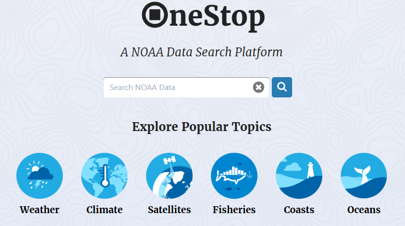
NOAA OneStop enables searching vast data holdings of geophysical, oceans, coastal, weather and climate data. The OneStop Project is designed to improve NOAA’s data discovery and access framework. Focusing on all layers of the framework and not just the user interface, OneStop is addressing data format and metadata best practices, ensuring more data are available through modern web services, working to improve the relevance of dataset searches, and advancing both collection-level metadata management and granule-level metadata systems to accommodate the wide variety and vast scale of NOAA’s data.
A centralized access point to Arctic and Antarctic data, services, and information across NOAA line offices and partners can be found in NOAA NCEI’s Arctic, Antarctic, and Polar Data Portal. This portal is in its early-stages of development, but is planned to grow over the upcoming year.
The Alaska Ocean Observing System’s Data Portal contains scientific and management information including real-time sensor feeds, operational oceanographic and atmospheric models, satellite observations and GIS data sets that describe the biological, chemical and physical characteristics of Alaska and its surrounding waters.
The Alaska Ocean Observing System (AOOS) is one of 11 regional systems across the US coast that represent NOAA’s Integrated Ocean Observing System (IOOS).
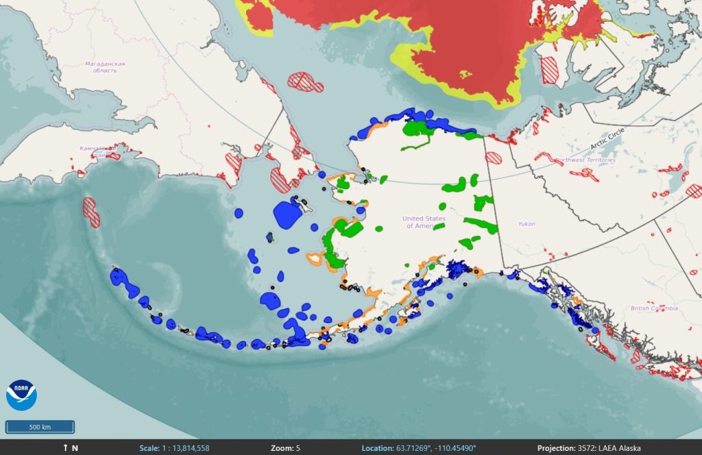
NOAA’s ERMA is a critical tool for equipping responders to prepare for, respond to, and assess the impacts of environmental disasters in this remote region. ERMA brings together information like the extent and concentration of sea ice, port and pipeline locations, and sensitive habitats, into one online tool. This allows experts to access data quickly and efficiently in the event of disasters like oil spills. Arctic ERMA can be used as a tool for collaboration among Arctic nations for planning and emergency response actions. Data from Canada, Russia and Norway are available and can be viewed in a variety of regionally-specific polar projections.
NOAA’s Alaska Fisheries Science Center Interactive Data Maps provides information about groundfish catch, tagging projects, and age distributions. Information on crabs, steller sea lions, ichthyoplankton, and fishing activities in Alaska can also be visualized. These long-term data sets are products of ongoing field studies and surveys to help managers and resource users better understand and predict marine life abundance in Alaska.